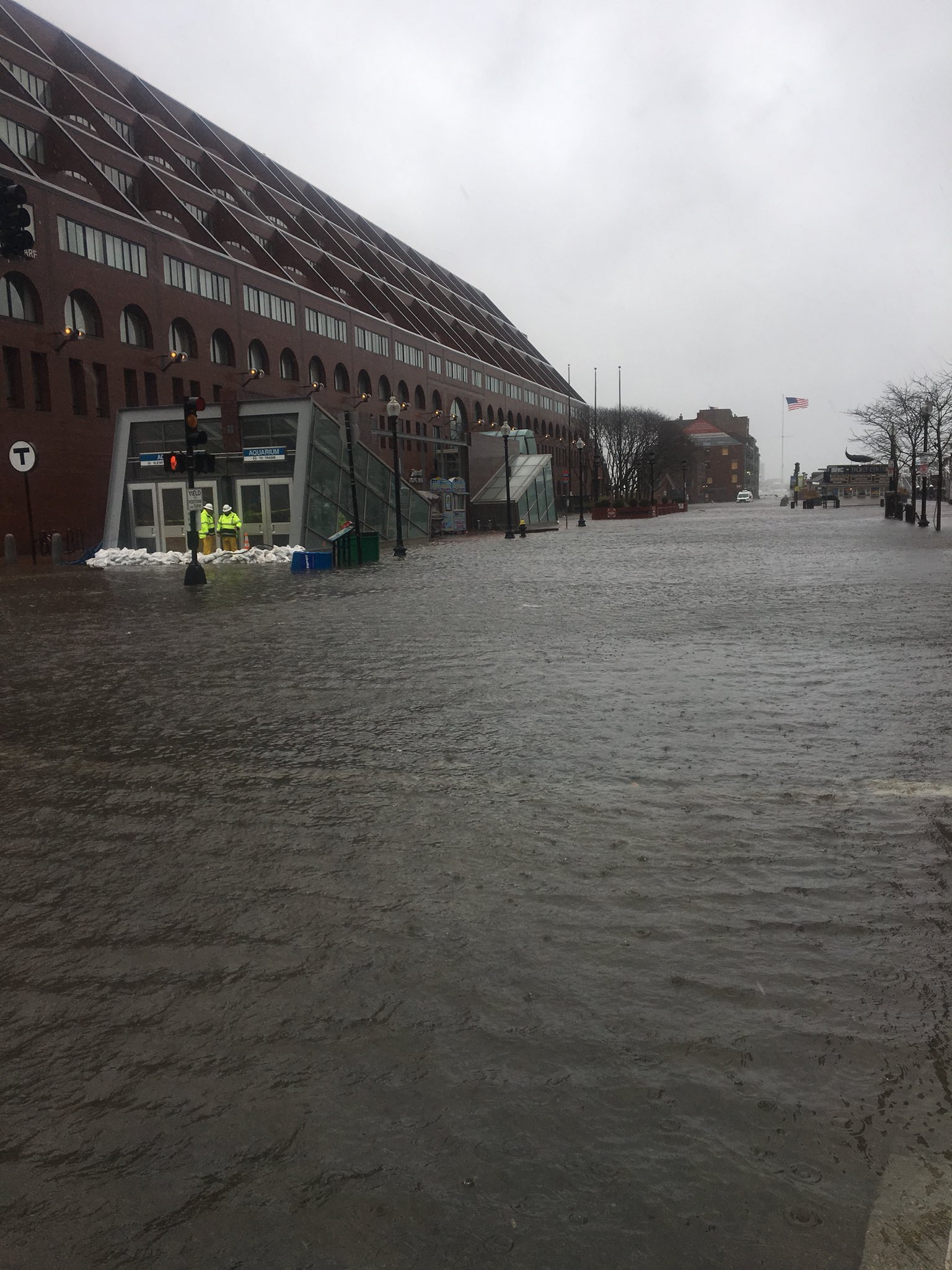
Flooding inundates Long Wharf in this March 2018 photo/Image courtesy of @ferryfaerie on Twitter
Boston officials are asking engineering firms to come up with solutions to flooding that threatens one of the downtown’s top transportation and tourism hubs.
The flood resilience mitigation study will focus on Long Wharf, home to commuter ferry and harbor cruise docking areas, an office building and Chart House restaurant. The wharf has been inundated by rising Boston Harbor waters in coastal storms and astronomical high tides in recent years.
The low-lying portion of the central waterfront has been identified in a Climate Ready Boston study as a likely entryway for flooding into the downtown area. By the 2050s, Atlantic Avenue will experience monthly traffic closures due to tidal flooding and sea level rise, according to the report, which estimated near-term costs for resiliency projects at Long Wharf at $28 million to $46 million.
Flooding in recent years has forced the temporary closure of the MBTA’s Aquarium station, located at the Atlantic Avenue end of the wharf area.
The Boston Planning and Development Agency issued a request for proposals this week for the engineering study of the city-owned property.
The wharf was originally constructed in the 1700s and currently consists of a concrete slab that sits atop wood timber piles. Existing structures include the Custom House Block office building and Chart House restaurant, along with ticket offices for cruise and ferry operators and a pavilion.
The 12-month study has an $800,000 budget and asks firms to select a flood mitigation strategy and conceptual designs, along with cost estimates.
Responses are due Dec. 16.