From the fast-food world this week comes a pair of stories at the intersection of transportation, GPS data tracking and commercial real estate.
Inrix, a Seattle-area company that tracks traffic patterns using GPS data, analyzed the effects on fast-food chains such as Chick-Fil-A, McDonald’s and Wendy’s when a Shake Shack restaurant opens in the neighborhood.
Using anonymized user data and geofencing around the properties, Inrix established that Shake Shack increases traffic to areas where it opens, a phenomenon that benefits competitors as well. That was the case in Denver’s Highlands Ranch neighborhood, where Chick-Fil-A and McDonald’s both lost market share but saw an uptick in overall visits.
The study analyzed standalone properties, so wouldn’t have been useful to gauge the impact of Shake Shack’s 2016 arrival in an urban storefront such as 77 Seaport Boulevard in Boston.
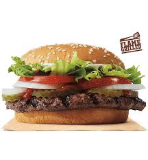
But from traffic-choked Mexico City comes another GPS fast-food application that could be better-suited to Massachusetts’ chronically-clogged arteries. Burger King has launched a “Traffic Jam Whopper” service in which gridlocked drivers can order food within a 3-kilometer radius of a restaurant using a voice-activated app. Couriers on motorcycles deliver the orders, using Google Maps data collected from app users. Burger King now plans to expand the program to Los Angeles, AdAge reported. Some outlets quickly dismiss the report as a publicity stunt fine-tuned for the age of congestion.
Which brings us back to Inrix, which released a report in February ranking Boston as the most congested rush-hour city in the U.S. The city Boston displaced, leapfrogging six spots in the rankings? Los Angeles. Cue the dystopian images of motorcycle couriers lugging Whoppers through the O’Neill Tunnel.


