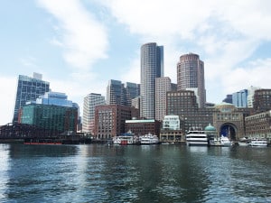
Rising sea levels are expected to bring new rules for new construction and retrofits to buildings in Boston’s flood-prone neighborhoods.
A proposed coastal flood resilience overlay district released today reflects the need to elevate structures in “inundation areas” that are expected to flood during major storms, given a projected 40-inch rise in sea level between 2070 and 2100. The proposed changes include new requirements for building heights, setbacks, lot coverage and gross floor area. They also prohibit living space below projected flood elevations.
Properties included in the “inundation area” are now identified on the Boston Planning and Development Agency’s online zoning viewer. The overlay district reflects a set of design guidelines approved in September.
Among the proposed changes:
Building height: Projects heights will be measured from two feet above base flood elevations that reflect future sea level rise;
Building setbacks: Allowances will be given for buildings that extend stairs and ramps needed for vertical circulation, and mechanical systems relocated from basements to side and rear yards;
Lot coverage and open space: Stairs, ramps and mechanical systems needed for vertical circulation and elevation above flood levels will be excluded from lot coverage and open space calculations;
Gross square floor area: Structures needed for vertical circulation or needed for flood protection will be excluded from calculations;
Use limitations below projected sea level rise flood elevations: Building areas below the projected sea level rise flood elevation will be limited to use for vertical circulation, flood prevention, storage and parking.
The BPDA has scheduled a pair of virtual meetings at 6 p.m. on Jan. 13 and 10 a.m. on Jan. 15, and a public comment period runs through Feb. 12.
“In order for Boston to grow and thrive for generations to come, we must make sure that what we are building today is resilient and protected from impacts of climate change,” BPDA Director Brian Golden said in a statement.
The rezoning does not address potential financial requirements of property owners to pay for shore-based resiliency strategies. In September, the Boston Green Ribbon Commission recommended creation of a District for Resiliency Improvements (DRI) which would collect fees or taxes from affected properties along with public sources to pay for flood defenses such as new seawalls and absorbent living shorelines.


 |
| 


