

The federal government’s long-awaited plan to protect Boston from rising seas may leave some landmark waterfront properties at the mercy of the ocean. Photo by James Sanna | Banker & Tradesman Staff
The federal government’s long-awaited plan to protect Boston from rising seas is set for release next month, including one potential route for a downtown flood barrier that’s raising alarms among waterfront property owners.
The U.S. Army Corps of Engineers has presented preliminary options including a flood barrier running behind some waterfront buildings – leaving landmarks such as the Boston Harbor Hotel exposed to sea levels expected to rise 40 inches by 2070.
“The alignment would abandon all of the environmental, economic and historical aspects of Boston’s Wharf District and let them be destroyed by rising water,” said Marc Margulies, president of the Wharf District Council organization, which represents downtown waterfront property owners.
Controversial Option Leaves Out Some
The Wharf District Council has lobbied for a flood wall alignment roughly following the Boston Harborwalk, protecting the New England Aquarium and the row of Atlantic Avenue hotels, office buildings and Harbor Towers condominiums that sit next to the water’s edge.
The alternate route runs across the middle of Long Wharf and jogs behind Boston Harbor Hotel before turning further west toward Atlantic Avenue south of the Harbor Towers.
In a letter to Boston’s Congressional delegation, the Wharf District Council also urged the Army Corps to integrate stormwater management along with a flood barrier. The stormwater system could include underground cisterns that retain stormwater that drains toward the waterfront from a large portion of downtown, and release it gradually, minimizing flood impacts.
The Army Corps is expected to host a presentation on its Coastal Storm Risk Management feasibility study for Boston’s 47 miles of coastline in mid-July. It will include recommendations for capital projects such as elevated seawalls and flood barriers to protect low-lying neighborhoods from coastal flooding that is expected to intensify in coming decades.
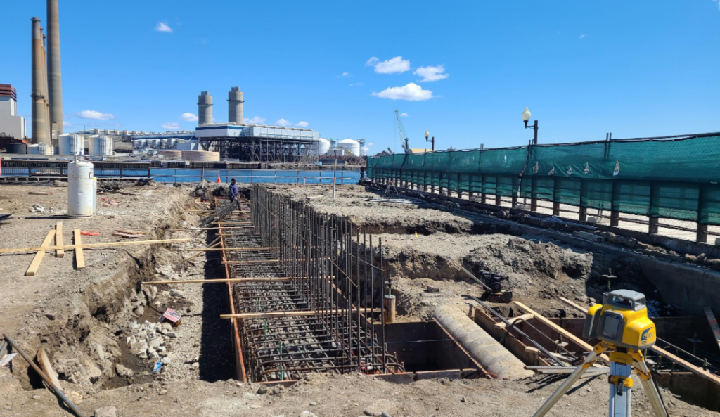
Boston has approximately 40 coastal resiliency projects planned or under way. In Charlestown, the $25 million Ryan Playground project includes a new flood prevention berm along with upgrades to athletic fields and play areas. Photo courtesy of the city of Boston
Disaster Provides Political Will for Action
The report is the first step in a three-step process culminating in an Army Corps decision on Boston projects, which would be eligible for 65 percent federal funding.
The remaining 35 percent is expected to be paid by a combination of city, state and private funding.
Consultants Arcadis this month were selected to conduct an 18-month study of who will pick up the tab, and cost-benefit ratios for resiliency projects in Boston. The Dutch sustainability consultant was lead designer on New York’s East Side Coastal Resiliency project, a $1.4 billion project nearing completion in Manhattan.
Hurricane Sandy’s devastation of New York City neighborhoods in 2012 prompted the city to take action on the six-year project, which includes a 2.4-mile flood protection network and elevated East River Park.
“When you have a big disaster that provides both the political will as well as the funding to advance things, then you can ride that wind in your sails for a while, unfortunately, from something that was really quite catastrophic,” said Carly Foster, Arcadis’ water management practice director.
Boston has an opportunity to act before a similar magnitude storm batters its coastline, Foster said. But like other jurisdictions, the city is still in the early stages of determining funding formulas for coastal defenses.
About 30 percent of the city’s waterfront is privately owned, although inland properties that would benefit from flood defenses also could be required to contribute to projects.
One option is special assessments on properties tied to reduced risk and avoided losses in property values, Foster said. Another model is stormwater fees based upon a property’s impervious surfaces. And resilience districts are a way to spread costs consistently throughout a neighborhood that benefits from a specific project.
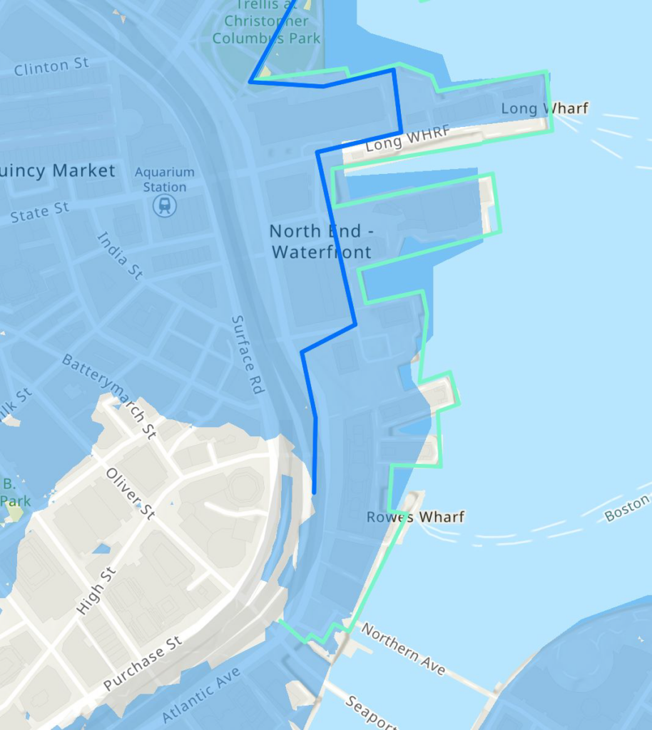
An Army Corps of Engineers study key to securing federal funding for flood defenses is poised to recommend two potential floodwall routes. One alternative (blue line) would see a floodwall built on land. The other (teal line) would see more extensive construction approximately along the current high-tide line. Image courtesy of the Army Corps of Engineers and the City of Boston
Green Ribbon Commission Focuses on Benefits
The $350,000 Arcadis study was sponsored by the Boston Green Ribbon Commission, a partnership between the city and local business and civic leaders on issues related to climate change. It follows a series of neighborhood-level studies conducted by the Green Ribbon Commission over the past decade.
Approximately 40 smaller resiliency projects are already planned or in progress, and the city is planning to build two storm barriers in the Seaport District scheduled to be completed by 2030. The project includes elevated sea walls on Northern Avenue and Drydock Avenue.

Steve Adams
The Green Ribbon Commission is turning its attention to studying funding options such as insurance surcharges that could be used to pay for coastal defenses, said Rebecca Herst, the commission’s director of climate resilience.
It’s also gearing up to make the financial argument for one of the region’s biggest public works projects since the Big Dig.
“When we talk about benefits in Massachusetts, we often are just focused on the property losses avoided,” Herst said. “But we’re also talking about property tax preservation, insurance availability and affordability, new jobs, public access, preventing displacement and maintaining housing supply. We’re thinking holistically about how this is a big investment in the future of the city.”

Climate studies predict large portions of Boston’s Financial District would be inundated in a major coastal storm in coming decades as sea levels rise, following a flood path near Long Wharf. Photo by James Sanna | Banker & Tradesman Staff